Tips on finding good visibility in fresh water Lakes:
If you want the best visibility you can get in a lake divide the lake in half and dive in the dam half as the water on the inlet side may have not had enough time to settle down. Also dive on the points, near small islands, and look for under water hill tops out in the lake. Do not dive near the main land when possible, in order to stay away from run off. By no means dive in coves and expect to get the best visibility. Check the weather. Cloudy and over cast days are not good vis days. Choppy water cuts down on Visibility. Which means high wind, low vis. The more the boat traffic the less the visibility as it also causes choppy water. Rain! While you more than likely find good visibility in the rain it is after the rain that visibility goes bad. In most cases for the next day or two, maybe even three. So don't plan a dive trip just after a rain at the site. Thick thermo cline means visibility will decline. That means from about the second or third week of July to about mid or late December is the worst time to dive and find great visibility. Another way to look at it is, from Memorial day to labor day it is more difficult to find the best visibility and the biggest reason for that is people competing for fun at the lake and heavy boat traffic comes with people. In a nut shell go on sunny days with no wind and no boats, that translates to middle of the week on most lakes. Tuesday Wednesday and Thursday are the best and sometimes Fridays are great. I also have found that walls in very deep water tend to have good visibility as the silt will go deeper than you want to dive leaving you with cleaner water, the deeper the water the better the visibility. You don’t have to go deep just be where you can if you want to. During summer time good visibility is only found by going fairly deep. You have to get below the thermo cline to really enjoy it. That does mean colder water. I use a 7MM farmer John, on almost all dives and have no problem finding good visibility. Usually deeper than 50 feet. The deeper the clearer. From mid December through early June you can see at almost any depth any where. Which means the colder and deeper the better. I hope this was of some help . One last thing. Even when all is in place for the best dive ever that does not mean it will be there. Some times it is just plain old good luck, which increases with the more dives you do. Just don't give up after one dive on a Lake. The more you dive it, the better the chances of finding that great dive day. Good Luck and Good Diving.
Darrell Maddox Divemaster
Semper Fidelis
How to get Maps I bought the Fishing Hot Spots map that you will see here at Sports Academe in Little Rock but they can be purchased else where I am sure. The cost is in the neighbor hood of seven dollars. You can also call 1-800-all-maps for a free catalog or go online at Fishinghotspots.com to check them out.
You can get USGS maps from Vardelle Parham Geology Center, 3815 West Roosevelt Road, Little Rock Ar. 72204 They even do business through the mail. Vardelle Parham Geology Center 3815 West Roosevelt Road Little Rock, AR 72204 General Phone: (501) 296-1877
Free topo Maps
A good site for free TOPO maps that you print out on your computer take a look at Mapper.acme.com it is a little like Google Earth but you can print out the maps. This info was provided to me by Drew Moffitt. Thanks Drew.
MAP & PUBLICATION ORDERING INFORMATIONMAP AND PUBLICATION SALES Phone: (501) 296-1877ARKANSAS GEOLOGICAL COMMISSION Fax: (501) 663-73603815 WEST ROOSEVELT ROAD E-mail: Map & Publication SalesLITTLE ROCK, AR 72204 In subject box, type: ATTN: Map & Publication Sales You can order maps and publications in person at our office, or by telephone (501-296-1877)Payment methods accepted are: personal check, cash, money order or credit card (MasterCard, Visa, or Discover)Prices and shipping subject to change without notice. Directions To the Geology Center Coming from the south on I-30, exit at University Avenue (Hwy 67), proceed north to Asher Avenue. From University (67), turn east onto Asher Avenue. When proceeding east on Asher Avenue, bear right at the 2nd stoplight (Y junction), then turn uphill on the 1st drive to the right and go to the top of the hill. Coming from the north or east on I-30, exit at Roosevelt Road and proceed west on Roosevelt Road. Note Barton Coliseum on your left. Just before you come to the stoplight, turn left and go to the top of the hill. The Vardelle Parham Geology Center is the green, 2-story concrete-block building on your right on the top of the hill.
General Information about Greers Ferry Lake
Dam Site Marina No Scuba Air
Description: Campground is located on the lake shoreline near the dam adjacent to Heber Springs, AR.
Location: From Heber Springs, AR, take Hwy 25 1/2 mile north and follow signs into the campground.
Facilities: 252 campsites (158 with electric of which 49 will have 50 amp service, 94 without) 40 campsites have water hookups available at the site.
Fees: $12 for non-electric, $15 electric, $17 prime, $18 with water.
Open: April 1 – Nov 1; Reservations available May - September, 2008.
Phone # (501) 362-2333
Heber Springs Marina Scuba Air $12.00 The only Scuba air on the lake
Description: Campground is located on the lake shoreline adjacent to Heber Springs, AR.
Location: From Heber Springs, AR, travel 2 miles west on Hwy 110, then 0.5 mile north on Park Road. Follow signs into the campground.
Facilities: : 142 campsites (106 with electric, 36 without), flush and vault toilets, showers, drinking water, trailer dump station, launching ramp, swimming area, playground, picnic shelter and marina.
Fees: $12 for non-electric, $15 electric, $17 prime.
Open: April 1 – Nov 1; reservations available May – September, 2008.
Phone # (501) 362- 8838
Cherokee No Marina NO Air
Description: : Campground is located on the north side of the lower lake just west of Silver Ridge Peninsula.
Location: : From Drasco, AR, take Hwy 92 West 7 miles then 3 miles south on Brownsville Road. Follow signs into campground.
Facilities: 33 campsites (16 with electric, 17 without), vault toilet, drinking water, trailer dump station, launching ramp.
Fees: $10 non-electric, $12 electric, $14 prime electric.Open: : Open May - September, 2008.
Narrows Marina No Air
Description: Campground is located near center of lake adjacent to Greers Ferry, AR.
Location: : From Greers Ferry, AR, take Hwy. 16 southwest for 1/2 miles. Follow signs into the campground.
Facilities: 60 campsites with electricity, flush and vault toilets, showers, drinking water, trailer dump station, launching ramp, picnic shelters and marina.
Fees: $15 electric, $17 prime.
Open: April 1 – Nov 1; reservations available May – September, 2008.
Phone # 1 (501) 825-6214
Old Highway 25 No Marina or Air
Description: Campground is located on the lake shoreline 1 mile northwest of the dam.
Location: From Heber Springs, AR, take Hwy 25 6.25 miles north to Hwy. 25S. Travel Hwy. 25S 3 miles west and follow signs into campground.
Facilities: 125 campsites (89 with electricity, 36 without), group camp area, flush and vault toilets, showers, drinking water, trailer dump station, launching ramp, swimming area, playground and picnic shelters.
Fees: $12 for non-electric, $15 electric, $17 prime, group camp area $150/night.
Open: April 1 – Nov 1; reservations available May – September, 2008.
Shiloh No Air
Description: Campground is located on the mid-lake shoreline south of Greers Ferry, AR.
Location: From Greers Ferry, AR, travel 3.5 miles southeast on Hwy. 110, and follow signs into the campground.
Facilities: 116 campsites (60 with electricity, 56 without), group camp area, flush and vault toilets, showers, drinking water, trailer dump station, launching ramp, swimming area, playground, picnic shelter and marina.
Fees: $12 for non-electric, $15 electric, $17 prime, group camp area $150/night.
Open: April 1 – Nov 1; reservations available May – September, 2008.
Phone # 1 (501) 825-6237
Group Camping
Description: : Two parks on the lake, Old Highway 25 and Shiloh, have group camp areas designed for larger groups who wish to camp together.
Location: : For Old Highway 25, from Heber Springs, AR, take Hwy 25 6.25 miles north to Tumbling Shoals, AR and Hwy. 25S. Travel Hwy. 25S 3 miles west and follow signs into campground. For Shiloh, from Greers Ferry, AR, travel 3.5 miles southeast on Hwy. 110, and follow signs into the campground.
Facilities: Old Highway 25’s camp area B has 16 campsites without electricity, flush toilet, drinking water, launching ramp and picnic shelter. Showers are available elsewhere in the park.
Shiloh’s camp area I has 17 campsites without electricity, vault toilet, drinking water, launching ramp and picnic shelter. Showers are available elsewhere in the park.
Fees: $150 per night. Reservations for these areas may be made through the National Recreation Reservation Service.
Open: April 1 – Nov 1; reservations available May - September, 2008.
John F. Kennedy Not on Lake, but good camp site and a must see for (Trout hatchery)
Description: Campground is located on the left, descending bank of the Little Red River just below Greers Ferry Dam.
Location: From Heber Springs, AR, take Hwy 25 north 4 miles, cross dam, and turn right on the second road.
Facilities: 74 campsites with electricity (13 have water hookups), flush toilets, showers, drinking water, trailer dump station, launching ramp, playground and picnic shelter.
Fees: $15 electric, $17/$18 prime.
Open: All year; reservations available April – October, 2008.
General Information for Lake Ouachita
Brady Mountainhttp://www.bradymtn.com - 74 campsites Scuba Air @ MarinaLocation: 13 miles west of Hot Springs on Highway 270W, then 6.1 miles north on Brady Mountain Road. Campsite description: Concrete table, ground grill, pedestal grill, lantern post, shadeAmenities: Flush toilets, potable water near sites, showers, boat ramp, playground, hiking trail, pavilion, picnic area, amphitheater, trailer dump station, swim beach, fish cleaning station, handicap accessible site (# 59). 50 amp sites available. Nearby facilities: Brady Mountain Resort - full service marina, restaurant, lodge, cabins, horseback riding, miniature golf, scuba shop, pay phones, boat rental.
Crystal Springshttp://www.crystalspringsresort.com - 74 campsitesLocation: 16.8 miles west of Hot Springs on Highway 270W, then 1.5 miles north on Crystal Springs Road. Campsite description: Concrete table, ground grill, pedestal grill, lantern post, water hookups, shade.Amenities: Flush toilets, potable water at sites, showers, boat ramp, trailer dump station, swim beach (2), fish cleaning station, handicap accessible sites (# 22 and # 73). 50 amps sites available, overflow camping (major holidays only), trails. Nearby facilities: Crystal Springs Day Use Area - Picnic area, playground, pavilions (2), boat ramp, fish cleaning station, amphitheater. Crystal Springs Resort - full service marina, boat rental, restaurant.
Joplinhttp://www.mountainharborresort.com- 64 campsites Scuba Air @ Marina by Ocean ExtremeLocation: Highway 270, 24 miles west of Hot Springs on Highway, then 1.9 miles north on Mountain Harbor Road. Turn left at campground sign (straight will lead into the marina).Campsite description: Concrete table, ground grill, pedestal grill, lantern post, shade. Campsites are not level and caution is advised while establishing camp. *Not recommended for large trailers, large RV’s or units with “slide outs”*Amenities: Flush toilets, potable water near sites, showers, boat ramp, trailer dump station, swim beach, fish cleaning station, trails.Nearby facilities: Mountain Harbor Resort - Full service marina, boat rental, restaurant, Subway, lodge, condominiums, cabins, camping, meeting facility, Turtle Cove Spa, horseback riding.
Tompkins Bendhttp://www.shangrilaresortar.com - 77 campsitesLocation: Highway 270, 25 miles west of Hot Springs and 10.7 miles east of Mt Ida, then 2.1 miles north on Shangri-La Road. Turn left at campground sign (straight will lead into marina). Campsite description: Concrete table, ground grill, pedestal grill, lantern post, shade.Amenities: Flush toilets, potable water near sites, showers, boat ramp, amphitheater, trailer dump station, fish cleaning station, trails. 50 amp sites available.Nearby Facilities: Shangri-La Resort - Full service marina, restaurant, cabins, motel, boat rental.
Denby Point 67 campsitesLocation: Highway 270, 26 miles west of Hot Springs and 9.5 miles east of Mt Ida, then .3 miles north on Denby Road. Turn left at campground sigh (straight will lead into marina). Campsite description: Concrete table, ground grill, pedestal grill, lantern post, shade.Amenities: Flush toilets, potable water near sites, showers, boat ramp, amphitheater, trailer dump station, fish cleaning station, swim beach, playground, picnic area, trails. Nearby Facilities: Lake Ouachita Shores Resort - Full service marina, lodge, motel, bungalows, boat rental.
Class A Campground Fees $14 to $17 per night (March 1-October 31) $10 to $12 per night (November 1-February 28)
Reservations for Class Asites at these camping areas may be made by calling the National Recreation Reservation System's toll free number 1-877-444-6777 or on the internet at www.reserveusa.com. Reservations can be made for the period of May 1 until September 30. Campsites are available on a "first come - first serve" basis from October 1 until April 30.
CLASS BStephens Park- 9 campsitesLocation: Highway 227 in Hot Springs to Mountain Pine, then follow Blakely Dam Road past school. Park is on left at the base of Blakely Mountain Dam. Campsite description: Concrete table, ground grill, pedestal grill, lantern post, shade.Amenities: Flush toilet, potable water near sites, playground, pavilion, picnic area, boat ramp (Avery Park). Nearby facilities: Spillway Recreation Area (swim beach, group camp, picnic area, pavilion, fish cleaning station, boat ramp). Scuba AirSpillway Resort and Marina - marina store, scuba shop, cabin rentals, restaurant. http://www.spillwayresort.comLake Ouachita State Park - cabins, marina, dump station, trails, visitor center, camping, picnic area, showers, playground, beach.
Little Fir29 campsitesLocation: HIghway 27, 4.7 miles north of Mt Ida, then eaast on Highway 188. 8 miles on Highway 188, then turn right at campground sign (straight will lead into marina). Campsite Information: Concrete table, ground grill, pedestal grill, lantern post, water, shade.Amenities: Flush toilets, potable water on sites, boat ramp, fish cleaning station, dump station, one 50 amp available, . Group camping area available for $55. *No showers*.Nearby Facilities: Little Fir Landing - full service marina. -
Lena Landing10 campsitesLocation: Highway 7 north from Hot Springs, then left on Highway 298. Or from Mt Ida, 12.4 miles north on Highway 27 , then right at Storey on Highway 298. Turn south on Lena Landing Road, then 1.2 miles. Cross the wooden bridge, then turn left, and campground area will be on the right..Amenities: Boat ramp, flush toilet, dump station, potable water near sites. *No showers*.Nearby Facilities: North Shores Resort - full service marina, boat rental, cabin rental, restaurant, camping. http://www.northshoresresort.com -
Twin Creek15 campsitesLocation: Highway 270, 27 miles west of Hot Springs and 8.8 miles east of Mount Ida, then 1 mile on Twin Creek Road. Campsites: Concrete table, ground grill, pedestal grill, lantern post, shade.Amenities: Flush toilet, potable water near sites, boat ramp, swim beach, overflow camping (major holidays only). *No showers*.Nearby facilities: Bait shopes, Lake Ouachita Shores Resort, Shangri-La Resort, Mountain Harbor Resort, Mount Ida -
Class B Campground Fees :
$10 to $14 per night (March 1-October 31) $6 to $12 (November 1–February 28)All Class B campsites are non-reservable and are available on a “first come-first serve” basis year-round.
Day Use Fee AreasLake Ouachita has multiple areas available for day use activities such as picnicking, swimming, boat launching, hiking, and group functions. Group pavilions are available at the following locations: Stephens Park, Avery, Spillway, Brady Mountain, and Crystal Springs (2). These are a perfect setting for family reunions, birthday parties or company picnics. The pavilions are equipped with a large grill, tables, electrical outlets and lights. Reservations for the pavilions may be made starting January 1 by contacting the Lake Ouachita Field Office at (501) 767-2101. Fees range from $30 on weekdays to $40-$50 on weekends. There are 4 amphitheatres available for group functions at Lake Ouachita. These are available free of charge. Reservations can be made by calling the field office. Spillway Day Use area has a group camping area available for rent by reservation only. The fee is $30.
Day Use FeesBoat launching - $3 per vehicle Swimming - $1 per person, up to $4 per vehicle There is no fee for picnicking.
Annual PassesAnnual passes are available for purchase year-around and make a great gift for the holidays. Passes are valid for entry to Corps operated day-use parks nationwide. You may purchase them at the Corps of Engineers Field Office located next to Blakely Mountain Dam, Ruth’s Bait and Tackle at Twin Creek, T&S Bait and Tackle in Mount Ida, Shangri-La Resort, Mountain Harbor Marina, or from a Lake Ouachita Park Ranger. Cost is $30.00 per pass ($15 with Senior Pass). Passes will be good for 12 months from date of purchase. Annual Passes are valid for the following activities:- Boat launching-Swimming-Day Use entry fees (where applicable : :
Questions? Comments! E-Mail DarrellMadd1@yahoo.com Web Site Designed & Hosted by Darrell Maddox
Hello My name is Darrell If you love to dive, you may want to look at these sites, especially if you cannot afford to go to the tropics or some far off place every time you want to dive. If you want to dive in central Arkansas or in reasonable driving distance from central Arkansas, this is your site. When I was certified as an open water diver, all I wanted to do was go diving and found it very difficult to get good diving site information for free. It is my intention to write a short synopsis on where I dove The main factor I use to rate a site is visibility and in lake diving location is everything. You may dive one spot in a lake to find vis three feet or less and on the same day just a short time and distance later you may experience very good vis twenty feet or better. Don’t judge a lake by one dive experience or one day. Of course I have to say this, I am not saying dive these sites, and I take no responsibility if you do. All I am saying is; I dove them and this is my assessment of the dive sites. Good Luck and Good Diving! Darrell Maddox, Divemaster
Marinas at Greers Ferry http://www.greersferrylake.com/lakerecreation/marinas.html
Scuba shops at Ouachita. (Mt Harbor) www.oceanextreme.com
(Spillway next to Dam) http://www.spillwayresort.com/contact.htm
DATUM
Warning! Know your map! It may not be compatible with your GPS until you change your DATUM. There are two being used for the United States and your map and GPS are not necessarily the same in fact they are not if you have not changed it. The NAD Default on almost all GPS units is NAD83. The NAD on all current USGS maps is NAD 27. This is simple to change. Do not except the default settings. Set them for what you need. To do this on a GPS like mine is simple.
I use a Garmin etrix to change it turn the unit on and page to the Menu.
Then line down to SETUP. Then hit enter.
Now line down to units, hit enter.
At this point you can change the Position Format, Map Datum, Units, North Ref and Variance.
This is where I change the Position Format to UTM.
I then change the Map DATUM to the one my map uses NAD27 CONUS ( North American Datum 1927 continental United States)
I also change the units to Statute and the north reference to Grid. Then I leave the variance set to 0. Now my map and GPS speak the same language. Without doing this you will be off as much as several hundred meters. You should also ask when someone gives you a location which datum they are using.
General info: Google Earth uses NAD83 Unless I state differently I use NAD27 CONUS
Convert Lon & Lat to UTM and Vice Versa
How to convert to and from UTM, and the different Lon & Lat formats. Just set the position format to the one that you have. Now enter a waypoint and enter the information you have as that waypoint. Now remembering the way point just go to Position format and change it to the one you want then bring up that waypoint and you will have the new format.

Comments or questions
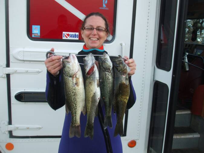
Spear Fishing
One Step to Adventure


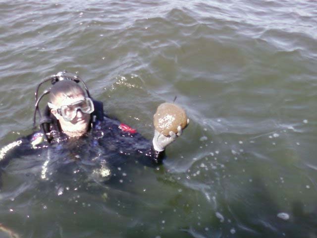
Fresh Water Sponge
If you have Google Earth and would like to
View Dive Sites via Google Earth click the kmz file below.
VIEW
DOWNLOAD
This is WAY TO COOL !!!
If you like my dive sites in the map format on their own page check them out in Google Earth.
If you do not have Google Earth on your computer click the link below to download it. Then salect the kmz file inder VIEW.
Ocean Extreme Dive and Travel http://www.oceanextreme.com
4501 Fairway
North Little Rock Ar. 72116
501 812 0006